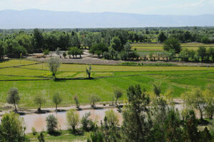
Takhar Province

This piece was written by Rahil (pseudonym) who lives in Afghanistan in Persian and has been translated to English by us. You can find the Persian version here.
Takhar is one of the famous regions of Afghanistan. The ancient Iranians or ‘Aryayee’ people referred to this region as Takharistan, where kings of ancient times would rule. Later, the region became known as Taliqan.
Takhar province lies in northern Afghanistan, and borders the provinces of Badakhshan, Panjshir, Kunduz, and the Amu Darya. On the north, Takhar is bordered by the country Tajikistan. Takhar is referred to as one of the Qataghan provinces.
One of the big resources of Taliqan is salt, produced in the Chal region of the province. According to the findings of Marco Polo in the thirteenth century, all the mountains in the province have salt, which would be sufficient for providing the whole world. Half-transparent glass salt is also prevalent in Taliqan. The salt of Taliqan is very hard, and cannot be collected without tools such as an axe. Hence, residents of the region use an axe to divide the salt into small cubes, which can then be transported elsewhere.
In the year 1343, a famous French historian excavated a large area along the Kukcha river, close to the Amu Darya, which is now known as ‘Ai Khanoum’. This city had been built according to a meticulous plan. It seemed to be the capital of Macedonian Kings, established after Alexander the Great. Ceramic pottery, and small and large statues in the Greco-Bodec have been found in the Ai Khanoum region, dating from around 200BC. At the same time, china dishes and engravings on them represent the civilization of the region centuries past AD, and reveal the ancient history of Takhar.
The southern part of Takhar is mountainous, while the north is flat. The Darqad region in the center of the province is characterized by grasslands and river- or stream- bordering hills. The snowy mountains and the lands surrounding the Amu Darya are characterized by humidity and rainfall, which are particularly prevalent in the spring. Takhar has a moderate mountainous climate, while in its flat regions, it has a savannah climate (with cold winters and hot summers). Hence, the fruits from Takhar are delicious, delicate and sweet. The majority of the population is involved in agriculture, trade, and farming.
Khushkak Mountains can be found in the south of the province, whereas the Khwoja Mohamad and Klufgan mountain ranges are to be found in the east, of which Mounts Ghanbar, Taqcha, and Chal are among Takhar’s famous mountains.
The biggest rivers of Takhar are the Kukcha River, Taliqan River, Farkhar River, and Chal River. Additionally, the Rustag region of Takhar is full of streams and smaller rivers.
The people of Takhar have preserved their ancient Iranian or ‘Aryayee’ culture. The sport of ‘Buzkashi’, celebration of the Persian New Year, and horse-back riding are some of their favorite activities. Women are often involved in carpet weaving and skilled in embroidery (suzani). They prepare traditional hats and gopicha chapan (traditional robes) for their men.
The city of Ai Khanoum is one of the historical highlights of this province. Although dating to about 200BC, it was completely destroyed during the Mongolian invasion of Central Asia led by Genghis Khan. However, since then, historians have managed to excavate and find many ancient Greco-Bactrian artifacts and coins from there. We have learned much about Greco-Buddhism from these.
The most important products from Takhar are salt (produced in large quantities), carpets, walnuts, pistachios, almonds, melons, wheat, rye, and corn. These are not only used locally but are also exported. In particular, the salt from Takhar is exported to all the provinces of Afghanistan.
Takhar province is divided into the following regions:
- Iskhashim
- Bangi
- Bahara
- Taliqan
- Chal
- Chah Ab
- Khowja Bahalideen
- Khwaja Ghar
- Darqad
- Dasht-e Qala
- Rustaq
- Farkhar
- Kul Afghan
- Namak Ab
- Warsaj
- Hazar Samuj
- Yangi Qala